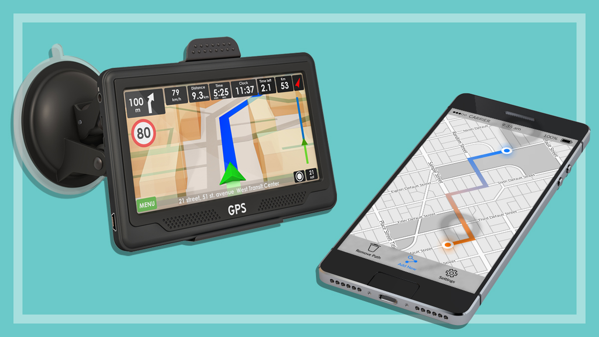
This guide will help you decide which type of device suits you best, and what to look for when you’re shopping for reliable car navigation.
How car navigation devices work
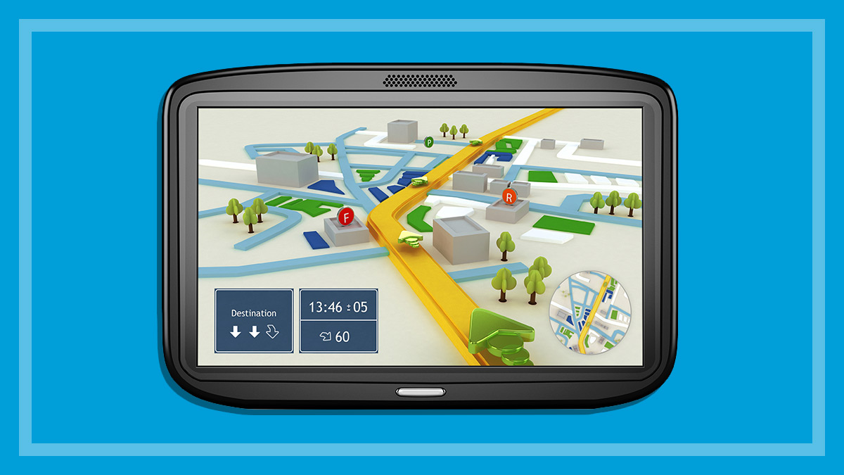
A global positioning system (or GPS) navigation device consists of:
a GPS receiver that picks up satellite signals to determine your exact position
a screen displaying maps and route instructions
a loudspeaker for verbal instructions
a computer processor to calculate routes, distances and times
a map database, including points of interest such as schools, police stations, car parks, petrol stations and hospitals.
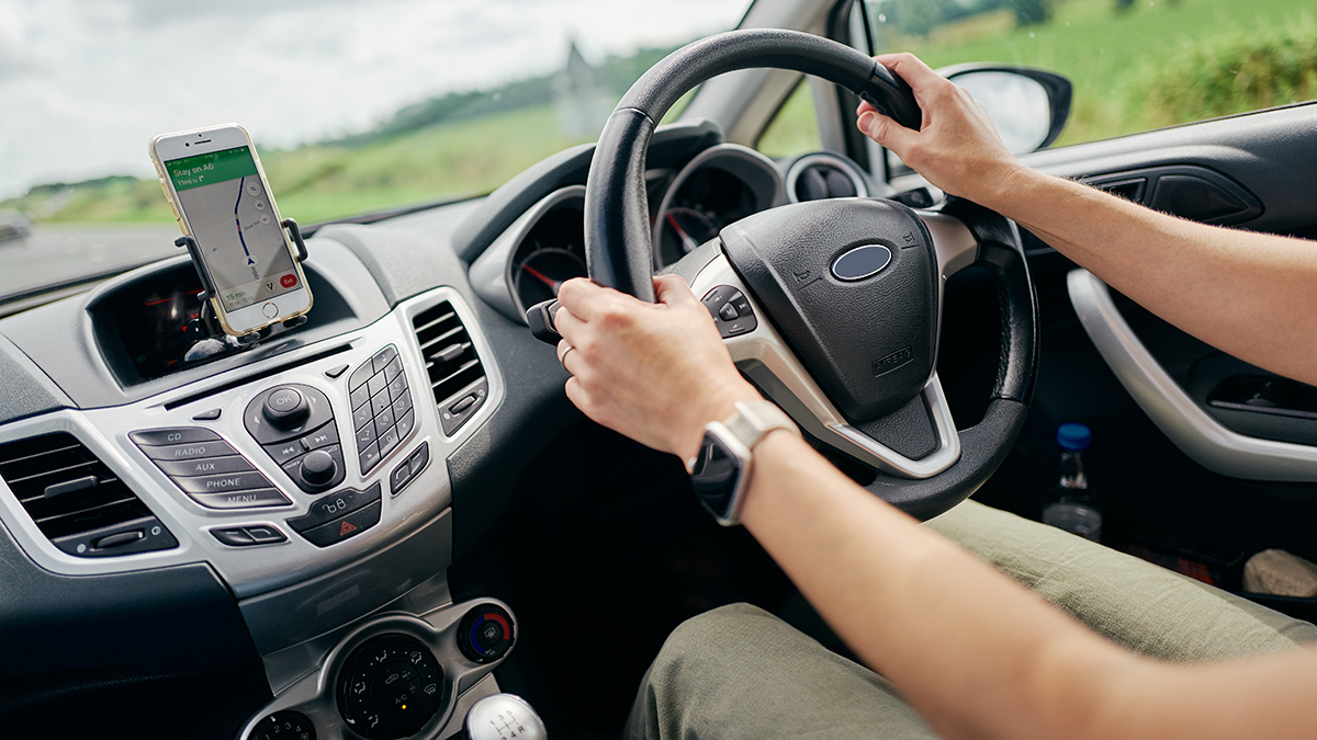
GPS apps for smartphones
When it comes to core navigation, GPS apps often perform just as well as a traditional unit, typically including safety camera warnings, trip planning and advanced lane guidance, for example.
Paid apps range from less than $10 up to as much as $90. However, there are a number of free apps available as well, including default map apps included with your Android or iOS device.
Android and iPhone users have access to the free Google Maps app, which shows your current position and offers voice direction. Apple has also released its own version for iOS devices that’s simply called Maps.
Maps are delivered in one of two ways. Apps either:
gradually download portions of the map as you enter new areas (his requires a 3/4G connection), or
download an entire state or country map in one hit over Wi-Fi.
Most apps that use 3 or 4G connectivity gradually download portions of the map as you require them, to save storage space on your smartphone. Though handy, this can put you at the mercy of mobile networks which are prone to dropouts depending on your carrier and location. Most smartphones also use A-GPS, where the “A” stands for assisted, which means 3 or 4G navigation are used to help enhance the GPS signal.
Apps can provide short term data such as temporary construction, police presence and crashes
Bear in mind that apps can chew through your monthly download limit if you download as you drive. Also, a country or state map obtained via Wi-Fi will take up a large chunk of storage on your phone, though it has less of an impact on data. While almost all GPS apps support 3 or 4G, far fewer give you the option to download maps for use in offline mode.
Downloading and data saving
Most people connect their smartphone to Wi-Fi at work or home which, by default, allows GPS apps to automatically update as they’re released. This is a very convenient feature compared to traditional GPS units, which require you to:
take your GPS out of the car
remove the memory card or plug it into a computer
download updates from the company website, and
transfer them to the unit.
How to use GPS systems and apps
It doesn’t take long to get your head around GPS units and their app equivalents. All you need to do is type in where you want to go and your device plots a route, calculates the travel distance and estimated time of arrival, and displays the route on a map. You can usually choose between the fastest or the shortest route (which aren’t necessarily the same) or specifically exclude toll roads or highways.
Using satellite signals, the system keeps track of your position and guides you along the plotted route with visual instructions on the display and verbal instructions via a computer-generated voice.
Traffic and travel
Many traditional GPS units and apps offer live traffic updates. These highlight congestion and either:
automatically change the route to avoid traffic
suggest different routes that you can follow or ignore, or
simply highlight traffic, putting the onus on you to find a new route.
In our car GPS testing, we found this feature to be consistently decent across all the brands and models that offered it. However, apps do have one advantage over GPS units:
GPS units can deliver traffic and information on long-term roadworks (e.g. new highways, tunnels etc.)
Apps provide this too, as well as short term data such as temporary construction, police presence, closed roads and even crashes.
Apps tend to be a bit better at rapidly updating temporary changes in traffic conditions beyond congestion. Waze is particularly useful in this respect, as drivers can submit updates via the app to inform other users in the area (a feature that’s starting to appear in Google Maps but not to the same extent as Waze).
Since the capabilities of a smartphone extend beyond navigation, they fall under different laws to GPS units and there are different rules depending on where you are in Australia.
The laws can refer to the GPS function as GPS, navigation, or a ‘driver’s aid’, among other terms.
Though this general information covers most usage scenarios, it’s worth checking your state or territory legislation for small differences that may apply if you own a special vehicle or have certain restrictions or exemptions on your licence.
The below information only applies to drivers in standard vehicles and doesn’t include motorbikes, trucks or heavy vehicles. It was last updated on 22/02/2023. Laws may have changed in your state or territory since publication.
Australian Capital Territory
Fully licensed drivers can use a smartphone as a driver’s aid. The smartphone must be securely mounted in a bracket without obscuring your field of view. Drivers can use voice commands to make or answer a call or use the audio functions (e.g. play music) but you cannot touch the phone while driving.
Learner, P1 and P2 drivers can use a ‘GPS enabled device’. The legislation doesn’t specify if smartphones are an accepted device, but the ACT City Service’s website says it’s OK, as long as the mobile device is secured in a mobile phone holder, using Bluetooth, and doesn’t require interaction by any means (including voice) while driving.
Fully licensed drivers can use a smartphone as a driver’s aid. The smartphone must be securely mounted in a bracket without obscuring your field of view. Drivers can use voice commands to make or answer a call and use the audio functions (e.g. play music) but you can’t touch the phone while driving.
Learner, P1 and P2 licence holders are not permitted to use a mobile phone at all while driving, which includes GPS functions.
Fully licensed drivers can use a smartphone as a driver’s aid. The smartphone must be securely mounted in a bracket without obscuring your field of view. Drivers can use voice commands to make or answer calls but you can’t touch the phone while driving.
Learner and P-plate licence holders are not permitted to use a mobile phone at all while driving.
Fully licensed, P2, and P1 drivers over 25 can use a smartphone as a driver’s aid. The smartphone must be securely mounted in a bracket without obscuring your field of view.
P1 drivers under 25 and all Learners are not permitted to use a mobile phone at all while driving, which includes GPS functions.
Fully licensed and P2 drivers in South Australia can only use smartphones for navigation if it’s fixed to the vehicle in a commercially designed and manufactured phone mount. Drivers cannot touch the phone while driving – you need to program in your journey before departing. If you need to make any changes during your trip, you must pull over and park first.
Learner and P1 drivers are banned from using all mobile phone functions while driving.
Fully licensed and P2 drivers can use a smartphone for GPS navigation. The smartphone must be securely mounted in a bracket without obscuring your field of view and you must not touch or press anything on the phone while driving.
Learner and P1 drivers are also permitted to use a phone’s GPS navigation, as long as it’s set up beforehand and you don’t interact with it in any way while driving. Crucially, the Tasmanian Road Rules (2021) from the Tasmanian government’s Department of State Growth specifies “interaction” includes “looking at the phone”, so these drivers might be restricted to using voice directions, rather than a phone’s screen.
Fully licensed drivers can use a smartphone as a driver’s aid. The smartphone must be securely mounted in a bracket without obscuring your field of view.
Learner, P1 and P2 licence holders are not permitted to use a mobile phone at all while driving, which includes GPS functions.
All drivers, including Learner, P1 and P2 licence holders, can use a smartphone as a driver’s aid.
The smartphone must be secured in a commercially designed mounting without obstructing your field of view, and you can’t touch the screen or any part of the phone while driving.
Are Android Auto and Apple CarPlay legal in Australia?
Android Auto and Apple CarPlay are driving apps that essentially mirror your smartphone to a compatible display unit in your car. The GPS runs through your phone, so it’s a really handy way to add navigation features to a car that doesn’t have built-in GPS.
However, these apps fall into a bit of a legal grey area. While you don’t need to access the phone once it’s connected to the display unit, it’s technically still in use in the vehicle. Australian states and territories don’t specifically mention Android Auto or Apple CarPlay, aside from Victoria which specifically prohibits their use for Learner, P1 and P2 drivers.
So it’s safe to assume that Android Auto and Apple CarPlay fall under existing phone GPS laws. This means fully licensed drivers can use them legally, while Learner, P1 and P2 drivers are subject to the same smartphone restrictions in each state and territory.
Data entry: Check how easy it is to enter addresses and routing preferences.
Display: This should be large and glare-free, and show the information you want to see – such as a two- or three-dimensional map view, distance to the next turn, current street name, time of arrival, and distance to destination.
Installation and portability: Check how easy the system is to attach, but also how easy it is to remove and carry or stow away.
Battery: This allows you to use the GPS away from a power supply for a short amount of time (typically two hours max).
Advanced lane guidance: This tells you when to move to the exit lane and displays complex multi-lane manoeuvres clearly.
Routing options: This feature can exclude toll roads, unsealed roads or highways from the calculated route.
Point of interest (POI) navigation: This is a great way to quickly find landmarks such as hospitals, police stations, shopping centres, tourist attractions and more. Some apps also allow you to call these places by selecting the phone number on the screen. While the free apps Google Maps and Apple Maps do have some POI categories, they largely depend on a search function rather than the category selections available on other apps.
Landmark navigation: This is similar to point of interest but can take you to local landmarks.
Map display selection: So you can view top down, behind, 2D and 3D, as well as preview the route before leaving.
Driving information: Displays speed, distance to destination and estimated time of arrival.
Itinerary planning: This allows you to set multiple stopping points along your route.
International maps: Handy if you wish to drive overseas. Almost all Australian GPS brands include New Zealand maps for free.
Lifetime map updates: Free map updates forever to cover new roads, routes and points of access, as well as permanent road closures.
Alerts: Receive notifications when you’re approaching fixed speed cameras and school zones so you can slow down.
Speed alert: This warns you when you exceed the speed limit for the road you’re currently on. Speed limit data can sometimes be inaccurate though, so don’t rely solely on the GPS for this information – check the speed limit signs.
Text to speech (TTS): This announces the street name so you know when to turn without having to glance at the screen. Some apps provide a choice of more than one voice (though no guarantees of correct pronunciation).
Voice recognition: This lets you control the GPS unit/app without touching it. Useful in states and territories where physical interaction with the device is illegal while driving.
Walking option: The system can plot a route for pedestrians – for example, ignoring one-way streets, or using walkways through parks.
Trip log: This records your travels and saves the information to post online in an application such as Google Earth. Although common on dedicated car GPS devices, this feature is also beginning to appear on car GPS apps as well.
Languages: You can select a number of other languages for the display and voice instructions (such as French, Spanish, German, Italian, Swedish, Danish and Dutch).
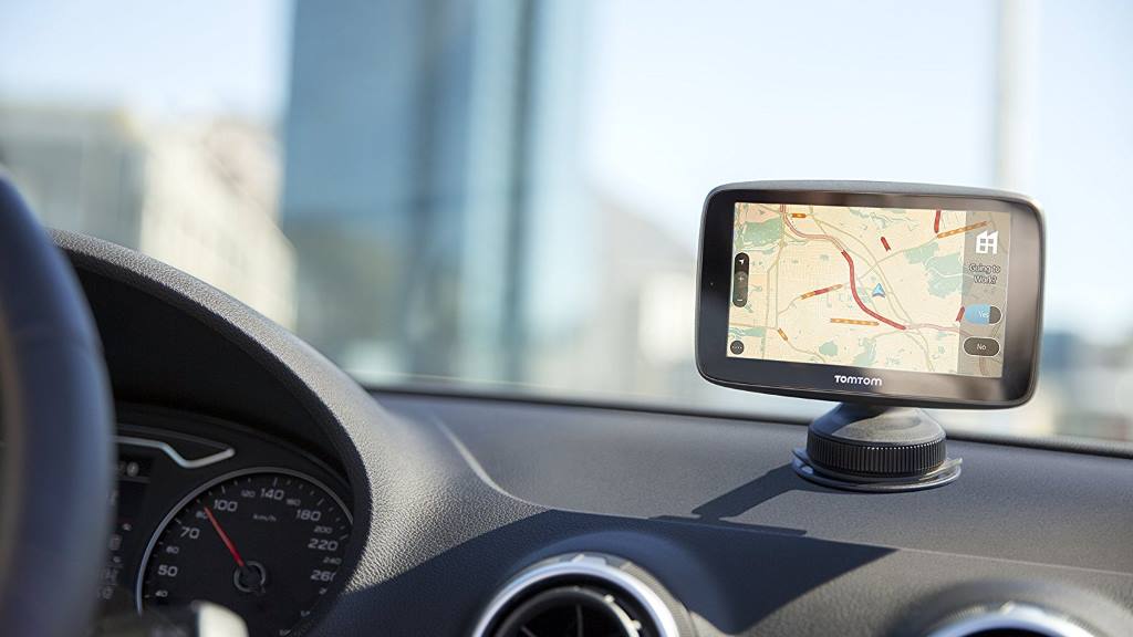
Portable or integrated?
Portable units sit in a cradle with a suction cap that can be attached to the windscreen. They plug into the cigarette lighter, but also have a battery that provides a few hours of operation. They’re installed within moments, and can therefore easily be moved from car to car. Smartphones mount in the same way.
Integrated systems are usually connected to the car’s electronics, and can overcome some of the limitations of portable units. For example, they can use speed information to keep calculating your position when there’s no satellite signal (such as in a tunnel).
Finding a GPS unit that fits your needs
You could argue that a GPS unit can maintain a stronger signal, as it’s built for one job in a larger case as opposed to a jack-of-all trades device like a smartphone, but this is a hypothetical position.
If you travel in an area with good mobile reception and have a full driver licence, then a car GPS app on your smartphone such as Google Maps, Apple Maps (for iPhone) and Maps (for Android) is a good option. The data download will not be an issue as long as you’re on a reasonable data plan (anything over 1GB per month will be fine).
If you travel a lot in marginal reception areas or if you don’t own a smartphone, then a dedicated car GPS is a very good option – they’ve never been more affordable or feature packed.
However, if you’re a Learner, P1 or P2 driver, or you own a non-standard vehicle such as a heavy truck or motorbike, laws will likely dictate your purchase options.
Peter Zaluzny is a Content producer in the Digital home team. He covers everything from home entertainment and personal safety devices to tech for your car and mattresses.
Peter enjoys cutting through the nonsense to help people understand the products they’re considering to buy. He helps consumers make educated, informed decisions.
Peter has a Bachelor's degree in Journalism and a Bachelor of Arts from the University of Wollongong.
For more than 60 years, CHOICE has been fighting the good fight for Australian consumers.
In the past year alone we've uncovered systemic issues with sunscreens, investigated shonky supermarket pricing, fought for stronger scam protections and helped make complex energy pricing fairer and clearer.
CHOICE is here to provide unbiased advice and independent testing in our world-class labs. We buy the products we test, just like you do, and our expert reviews are influence free. We’re here to help you choose smarter. Hopefully you’ll also save some money along the way.
Thanks to CHOICE, you’ll never be alone when a business treats you unfairly. You can support our work by joining or donating to our cause.